of
Bakonycsernye
|
Bakonyscernye: Views of Town Bakonycsernye is a town of about 3,300 citizens located in the northeastern Bakony Mountains in the Western Danube (Transdanubia) region of Hungary.. It now belongs to Fejer county. The decision to change from Veszprem County to Fejer County occured in early 1956. The region had some historical significance in the past, since a castle, called "Csikling Var",was built around the 1300s, although not much remains of it now. Light signals were used for communciation between castles sent from mountain tops. The town was settled in the 1720s and 1730s by Slovakians who primarily emigrated from Trencsin and Nyitra counties. Many of of local Hungarians had died during the Turkish wars and people were needed by the wealthy landowners to work the land. The region was well known for its huge agricultural production, primarily wheat, corn and other grains. The Slovak language is now spoken by very few citizens. While the town is recognized by the Hungarian government as having a "minority", and therefore receives recognition and certain rights under the Hungarian Constituion, the Slovak language is dying out. When I visited there in the mid-1970s, many of the older citizens still spoke Slovakian. The Lutheran church used to hold services in Slovakian, also. My own mother had learned the language as a child and can still speak fairly fluently. From the early 1900s well into the mid 1980s there was a mining industry. The Kisgyon and Balinka (banya) mines provided jobs for many citizens from Bakonycsernye and neighboring towns. It closed in the mid-1980s to early 90s. The town itself is elongated like the letter "Y"lying on its side. The two forked branches open going westward. They are named, "Arany Janos" directed SW to Zirc and "Jozsef Attila" leading NW to Sur. The main street is "Rakoczi Ferenc" which winds like a snake going north eastward towards Mor and Szekesfehervar. At one turn it is called "Akac" street. Going toward Mor it is "Petofi Sandor" street. VIDEO ABOUT BAKONYCSERNYE AND BRIEF HISTORY: http://www.youtube.com/watch?v=tAcrxYhY-jA&feature=related VIEW LANDSCAPES, VINEYARDS, and SCENES OF BAKONYCSERNYE: |
|
 |
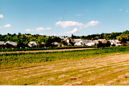
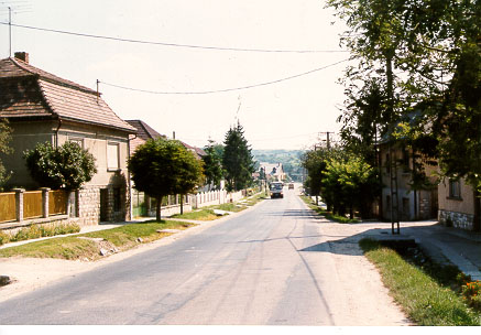
Near the end of the town ... going toward Mor. The red roofed building in the right lower corner |
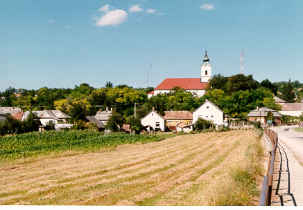
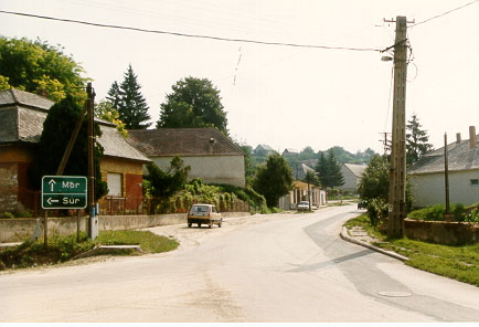
| Corner where streets to Zirc, Sur and Mor meet. The Bakonycsernye Lutheran Church (Baroque style)is over 300 years old. |
 |
 |
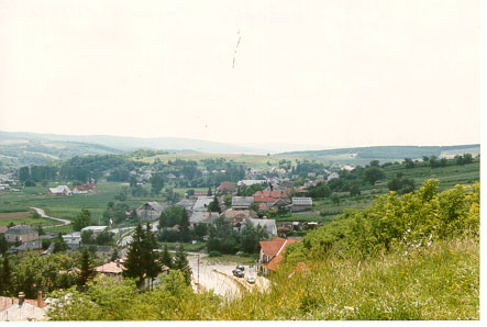
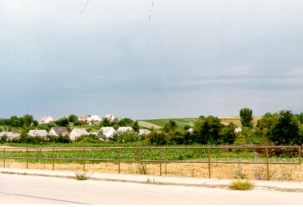
View from Pacman Hegy (Hill) The Bakony mountains can be seen. The distant landscapes are rich with the vibrant colors of nature. The homes in the center are the newest with a Western European and American style, including a one-car garage. |
| View of Pacman Hegy (Hill) in the distance ...
|
 |
 |
The yellow home was my grandmother's ... It was up for sale in Oct. 2003. My mother and I were urged to buy it. We have no need for a home in Hungary any more. |
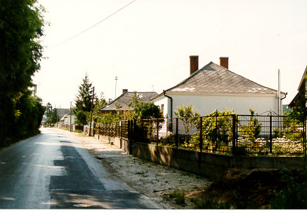
| Important corner - three roads diverge to Zirc, Sur, Mor Just past this corner house, turn left on the first street, and you can enter the church yard. Or walk past the church and a short way up the hill, you will find the gate to the "old cemetery." |
 |
 |
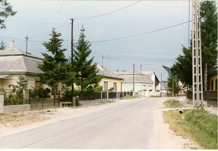
Pretty German and Swiss styled homes. |
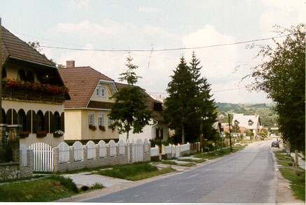
| Looking at "Tancsics Utca" ... used to be "Dollar Utca" In the 1900s, many residents on this street had gone to America to earn dollars. They returned and built their homes. So, it was called "Dollar Street" in the past ... |
 |
|
|
First home on right was my grandmother's. Behind the house is a long garden |
|
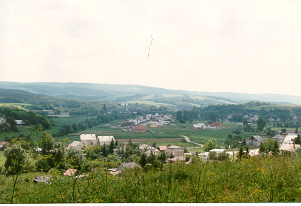
End of Jozsef Attila Utca - leads to Sur, next town. The main street is about 4 kilometers long. |
 |